
The world’s most advanced commercial high-resolution satellite is now operational. DigitalView’s WorldView-3–the company’s sixth super-spectral, hi-res satellite–was launched this week, and offers photo resolution at five times the clarity of its nearest competitor. The satellite also  provides infrared and CAVIS, and can photograph through smoke, fog and haze and correct for cloud, aerosol, water vapor, ice and snow.
The satellite was launched on a Lockheed Martin Atlas V rocket from Vandenberg Air Force Base, California last week, and is being offered for a number of commercial enterprises.
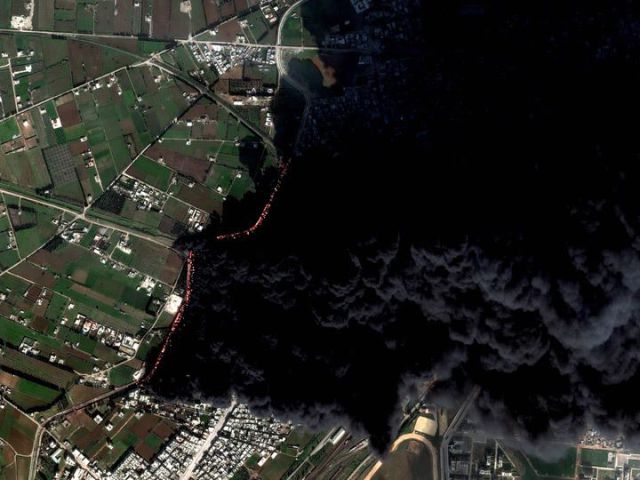
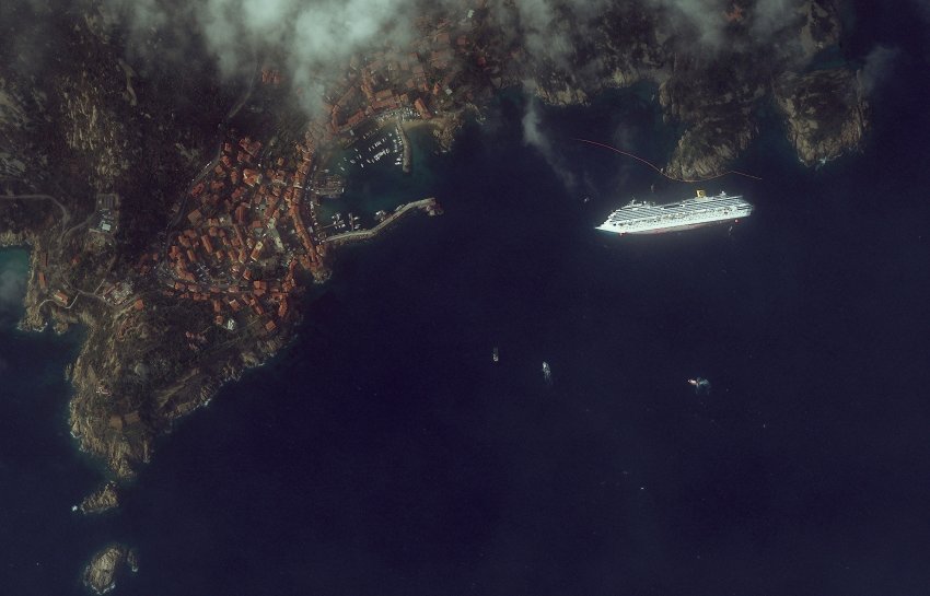
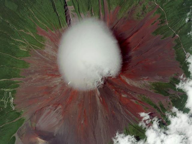
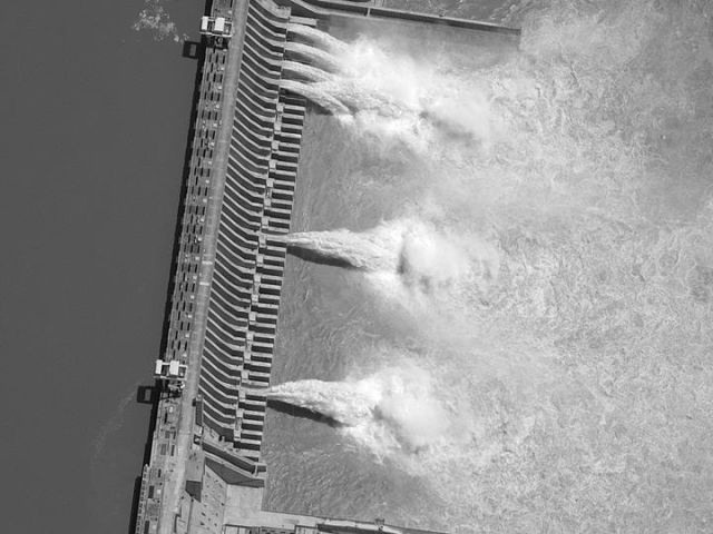
Natural disasters have already been photographed by DigitalGlobe’s satellite, such as New Jersey’s beaches during Hurricane Sandy, wildfires at High West Park, Colorado, the flood at Bangkok International Airport, and so have man-made events, such as the Gulf of Mexico spill, the Costa Concordia’s capsizing and Syrian pipeline fires.

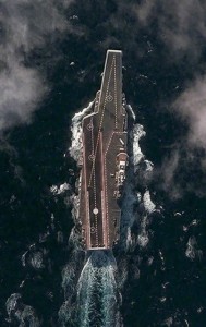
Serving political needs, China’s Liaoning aircraft carrier, Cairo’s Tahrir Square, North Korea’s Yongbyon Nuclear research center, Osama bin Laden’s compound and the Obama inauguration in Washington, DC have been documented in hi-res photographs.
Militarily, Australia’s Exmouth Naval Communications Station, the Pentagon, Pearl Harbor and Pyongyang’s military parades have been photographed, and culturally, Peru’s Machu Pichu, Egypt’s and Sudan’s pyramids, and the Colosseum have been captured.
Jeffrey Tarr, DigitalGlobe’s Chief Executive Officer announced the inauguration of the new satellite, “The successful launch of WorldView-3 extends DigitalGlobe’s commanding technological lead and will enable us to help our customers see through smoke, peer beneath the ocean’s surface and determine the mineral and moisture content of the earth below — all with unprecedented clarity.”
WorldView-3 is capable of 0.31 meter resolution super-spectral imagery–clarity five times that of DigitalGlobe’s nearest competitor. It also offers multiple shortwave infrared (SWIR) bands to photograph the earth through haze, fog, smoke and other airborn particles.
Another feature individual to WorldView-3 is CAVIS, an instrument that corrects atmospheric distortions due to cloud, aerosol, water vapor, ice and snow.
“The unmatched abilities that WorldView-3 brings to our constellation will enable us to provide our customers with information and insight never before possible and advance our efforts to create a living digital inventory of the earth,” said Tarr.
By Sid Douglas